It's nice to see some more trips happening recently. For my most recent little excursion I was struggling to make up my mind where to go. I really fancied a change from driving down the well beaten track to the Mournes, yet that familiarity would ensure that I would know exactly where I was comfortable to park, walk and camp.
The weather forecast however helped me rule out that location. Next on the list and perhaps quicker to get to was the Antrim Hills, but again the weather system was due to hit there at some point during the evening.
So it was settled, I'd go to the Sperrins, an area I was much less familiar with. A walk earlier in the year along part of
Hudy's Way inspired me to head to the village of Moneyneaney as a starting point. The village sits in the middle of two areas of high ground. One which includes Crockbrack and the other side which includes Mullaghmore. I weighed up the pros and cons and reckoned that Mullaghmore would probably be my choice, if a little more creepy, walking through Moydamlaght Forest for the start of the walk.
When I arrived at the village I noted that Crockbrack seemed to be sitting in more cloud so Mullaghmore was confirmed for me. A relatively short but slightly uncomfortable walk along a dark road with no footpath brought me to the forest. I say uncomfortable partly out of concern for my safety (I did have a torch at least) and partly out of not wanting to attract any attention to myself.
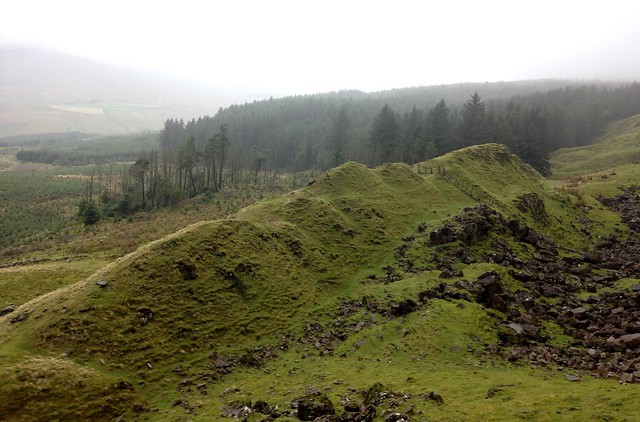
Not long into the walk I had managed to reassure myself that everything in a forest at night is more scared of me than I ought to be of it. That said, when the forest cleared and I was able to get a better feel for my progress and my surroundings it did feel better to me. At the upper reaches of the forest I came upon the area known as Craig-Na-Shoke, or Eagle's Rock.
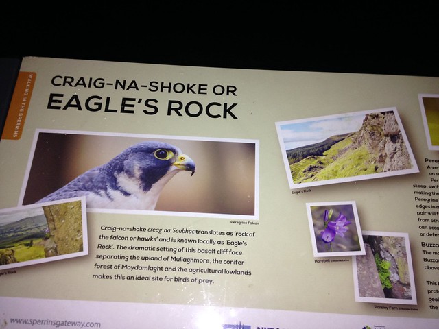
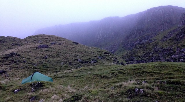
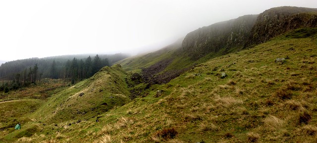
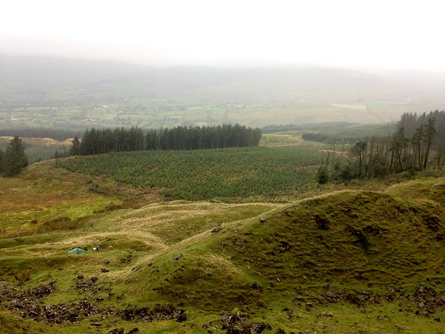
This bears a resemblance to Binevenagh in that a sheer rock face falls to meet a land form that resembles a series of jagged teeth. My aim was climb up onto the high ground above the cliffs however the visibility appeared to be poor up there and wind had already picked up somewhat as I had ascended even to my current height. I thought there was no advantage to climbing any higher, especially since I was unsure about the suitability of the terrain for camping on. Instead I set about finding somewhere level to pitch my tent, mindful that camping at the bottom of a boulder field would be best avoided!
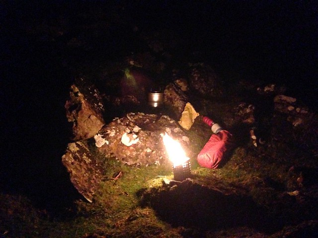
Some time later when I was pitched up and had a brew in hand it felt quite satisfying to be there, watching the distant lights of cars going about their business. As much as I enjoy sitting on the sofa watching a movie at the weekend it is nice to change that sometimes and instead sit on a secluded mountain with a book in hand.
After a restful sleep and not being aware of any rain overnight, I emerged from the tent to a dry and fresh morning.
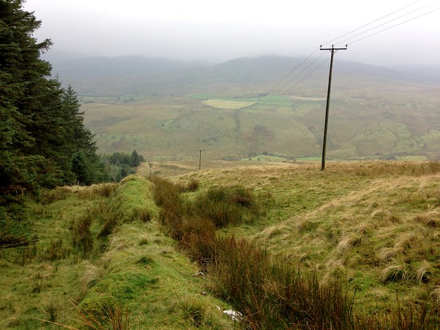
Unfortunately the mist hadn't cleared from the tops and having a bit more walking to do since I was starting lower than I had originally hoped, I set off quite early. I firstly visited the top of Bohilbrega where I only got the briefest of views through the cloud, enough though to know that the views would be great on a fine day. The top of Bohilbrega did resemble a bit of a building site with evidence of heavy peat harvesting using some fairly big equipment. Next I made my way through the fog to the summit of Mullaghmore itself. I'll have to take others word for it but apparently the views from here are excellent in the right conditions. Today it was just that of a telecommunication tower in the mist. From the summit I descended on a direct south-westerly direction down the boundary of the forest to the road from where I completed my lap back to the car.
The poor visibility gave opportunity to practice navigation but not to take photographs from the higher ground. It was nice to go somewhere new. I've not explored the Sperrins nearly enough and I've not seen many photos of wild camps there, hopefully this might be of interest to others thinking about it.
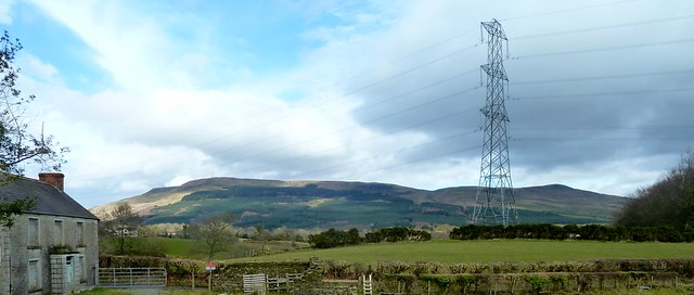
The following photo taken on an earlier walk on Hudy's Way shows Mullaghmore to the left with the transmitter tower visible on top and Bohilbrega to the far right. The cliffs of Craig-Na-Shoke are just distinguishable roughly in the centre.
Apparently it had rained very heavily for much of the night back at home. A mere 40 miles of a distance made all the difference. Sometimes a late call, having reviewed the weather forecast is the way to go.

 Follow NI-Wild


 Author
Topic: Mullaghmore wild camp, Sperrins - Oct 16 (Read 14220 times)
Author
Topic: Mullaghmore wild camp, Sperrins - Oct 16 (Read 14220 times)